Volcanoes Warn Trees Around Them Before Erupting, and NASA Can See It
Something extraordinary happens in the forests surrounding volcanoes that scientists only recently discovered. Trees begin to change in subtle ways that human eyes cannot detect, but satellites orbiting hundreds of miles above Earth can spot these changes immediately. Nature has been running its early warning system for centuries, and we’ve been missing the signals completely.
Imagine if plants could warn us when disasters are approaching. Picture forests that act like living mood rings, shifting colors to reveal hidden dangers brewing beneath our feet. What if the very trees we walk past every day hold secrets that could save thousands of lives?
NASA researchers made a breakthrough that sounds like science fiction but represents a complex scientific reality. Satellites now monitor changes in vegetation that occur before any visible signs of volcanic activity appear. But how do trees know what’s coming? What signals are they receiving that we can’t detect? And why did it take us so long to understand what forests have been trying to communicate?
Trees Turn Into Living Mood Rings Before Disaster Strikes
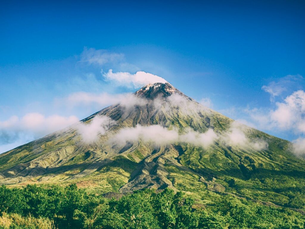
Deep underground, magma begins its slow journey toward Earth’s surface long before any eruption occurs. As molten rock rises through cracks in the crust, it releases gases, including massive amounts of carbon dioxide. Most people never notice these invisible emissions, but trees respond immediately.
Carbon dioxide acts like fertilizer for forest vegetation. Trees absorb extra CO2 and convert it into rapid growth and vibrant green coloration through enhanced photosynthesis. Leaves become more lush and healthy-looking as they process increased levels of carbon dioxide.
Human eyes can’t detect these subtle color changes, but satellite sensors capture variations in vegetation that indicate underground volcanic activity. Trees transform into biological sensors that reveal what’s happening deep beneath the surface.
Nature has created its volcanic monitoring system over millions of years. Scientists just needed sophisticated space technology to understand what trees have been communicating all along.
NASA’s Space-Based Tree Detectives: Satellites That Read Leaves
NASA’s Landsat 8 satellite now tracks vegetation changes around volcanoes worldwide, detecting color shifts that precede eruptions. Advanced spectrometers analyze light reflected from forest canopies, identifying subtle changes invisible to ground-based observers.
Researchers combined satellite imagery with the Airborne Validation Unified Experiment: Land to Ocean (AVUELO) project to create comprehensive monitoring systems. Scientists from Chapman University, Occidental College, and the Smithsonian Institution collaborate to understand how trees respond to volcanic gases.
Multiple Earth-observing satellites, including NASA’s Terra satellite and ESA’s Sentinel-2, now contribute to volcanic tree monitoring networks. Space-based detection systems offer early warning capabilities for volcanoes in remote locations where ground-based monitoring is impossible.
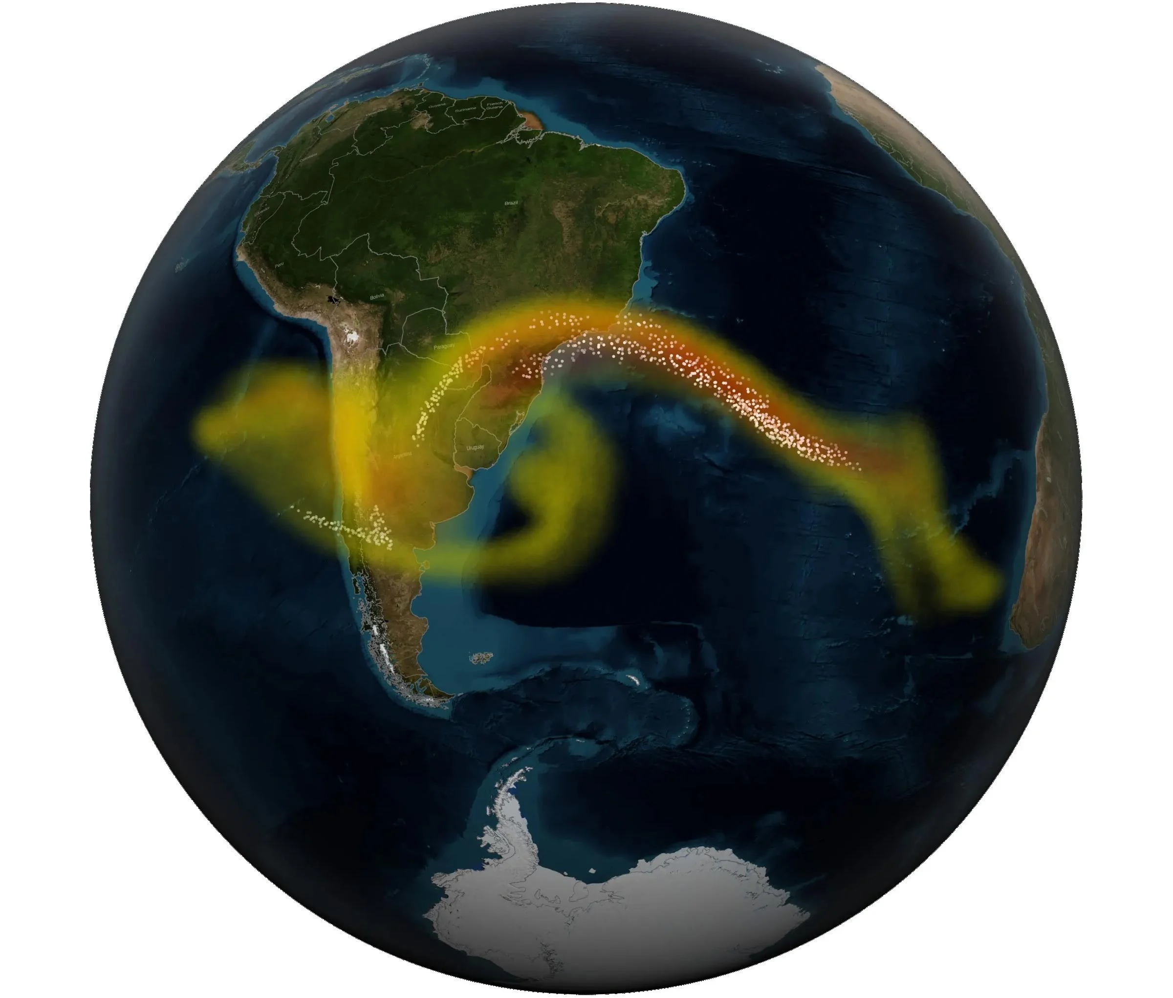
Nicole Guinn from the University of Houston conducted groundbreaking research around Mount Etna in Sicily, demonstrating strong correlations between the color of tree leaves and magma-generated carbon dioxide. Her study represents the first scientific evidence that satellites can reliably detect volcanic activity through changes in vegetation.
Slingshots and Science: Getting Sensors Into Forest Canopies
Field researchers use surprisingly low-tech methods to validate high-tech satellite observations. Scientists launch carbon dioxide sensors into tree canopies using sophisticated slingshots, combining cutting-edge technology with creative problem-solving.
Ground truth validation requires measuring actual CO2 levels around volcanic trees to confirm satellite readings. Researchers collect leaf samples while monitoring carbon dioxide concentrations, ensuring space-based observations accurately reflect ground conditions.
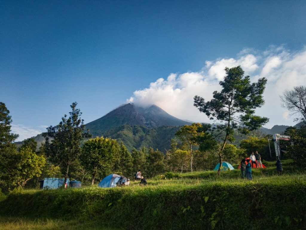
Josh Fisher leads interdisciplinary teams studying the responses of trees around Costa Rica’s Rincón de la Vieja volcano. Scientists install monitoring equipment throughout forest canopies to track how vegetation responds to changing volcanic gas emissions.
“The whole idea is to find something that we could measure instead of carbon dioxide directly, to give us a proxy to detect changes in volcano emissions,” explained volcanologist Robert Bogue from McGill University.
Ten Percent of Humanity Lives in Volcanic Danger Zones
Approximately 1,350 potentially active volcanoes pose a threat to populations worldwide. Roughly 10% of the global population lives within range of volcanic hazards, including flying rocks, toxic gases, mudslides, and tsunamis triggered by volcanic eruptions.
Many dangerous volcanoes are located in remote mountainous areas, where traditional monitoring methods prove expensive and hazardous. Scientists must trek through challenging terrain to install seismic equipment and gas sensors, making comprehensive monitoring nearly impossible for all volcanic threats.
The United States ranks among the most volcanically active countries in the world. Alaska alone contains over 130 volcanoes and volcanic fields that have erupted within the past two million years. Improved early warning systems could protect millions of Americans living near volcanic regions.
Early detection becomes vital because humans cannot prevent volcanic eruptions from occurring. Scientists focus on providing sufficient warning time for evacuations and emergency preparations before disasters strike.
Invisible Killer Gas That Trees Love
Volcanic carbon dioxide remains extremely difficult to detect directly from space because atmospheric background levels mask subtle increases from underground sources. “A volcano emitting the modest amounts of carbon dioxide that might presage an eruption isn’t going to show up in satellite imagery,” noted Bogue.
Major eruptions expel enough CO2 to register on NASA’s Orbiting Carbon Observatory 2, but early warning signals remain too faint for direct detection. Scientists must find indirect methods to track volcanic gas emissions before eruptions become imminent.
Trees provide natural amplification systems for weak volcanic CO2 signals. Plants concentrate carbon dioxide through photosynthesis, creating visible changes that satellites can detect even when gas emissions remain below direct measurement thresholds.
Rising magma releases carbon dioxide long before sulfur dioxide and other gases become detectable. Tree monitoring provides earlier warnings than traditional volcanic surveillance methods.
Real Success Story: 56,000 Lives Saved in Philippines
Mayon volcano in the Philippines provided dramatic proof that early warning systems save lives when properly implemented. Scientists upgraded monitoring networks to include both carbon dioxide and sulfur dioxide sensors around the volcano.
December 2017 readings detected signs of impending eruption, prompting government researchers to advocate for mass evacuations. Over 56,000 people evacuated safely before massive eruptions began on January 23, 2018. Early warnings prevented casualties that would have resulted from surprise eruptions.
Florian Schwandner from NASA’s Ames Research Center led the monitoring upgrade that enabled successful predictions. His team demonstrated how combining multiple detection methods provides more reliable eruption forecasting than single-sensor approaches.
Success stories like Mayon prove that investment in volcanic monitoring technology directly translates to saved lives and reduced disaster impacts.
Why Trees Sometimes Lie: Limitations of Leaf-Based Detection
Tree-based volcanic monitoring faces significant limitations that prevent universal application. Many volcanoes exist in climates that don’t support sufficient forest coverage for reliable satellite imagery.
Droughts, wildfires, and plant diseases can cause vegetation changes that mimic the effects of volcanic gases. Weather conditions and seasonal variations complicate the interpretation of satellite data on volcanic activity.
Different tree species respond variably to changing carbon dioxide levels. Forest composition affects the reliability of vegetation-based volcanic monitoring systems.
Scientists must combine tree monitoring with seismic data and ground deformation measurements to build comprehensive volcanic surveillance networks. No single detection method provides foolproof predictions of eruptions.
Beyond Silver Bullets: Adding Trees to Volcanic Toolkit
“There’s not one signal from volcanoes that’s a silver bullet. And tracking the effects of volcanic carbon dioxide on trees will not be a silver bullet. But it will be something that could change the game,” Schwandner explained.
Multiple monitoring methods provide redundancy that improves prediction accuracy and reduces false alarms. Tree surveillance complements rather than replaces traditional seismic and gas monitoring systems.
Satellite-based tree monitoring offers cost-effective surveillance for remote volcanoes where ground-based monitoring proves impractical. Space technology democratizes volcanic surveillance for developing nations lacking resources for extensive ground networks.
Combined monitoring approaches enable earlier warnings with greater confidence, potentially extending evacuation timeframes and reducing the impact of disasters.
Earlier Warnings Save More Lives
Satellite tree monitoring could provide volcanic warnings days or weeks in advance of traditional methods detecting impending eruptions. Earlier alerts enable more thorough evacuations and better disaster preparedness.
Technology development continues to make space-based volcanic surveillance more accessible and affordable. Improved satellite sensors and data processing capabilities enhance detection sensitivity for subtle vegetation changes.
Global monitoring networks could eventually track all significant volcanic threats worldwide. International cooperation in space-based surveillance would protect vulnerable populations regardless of national monitoring capabilities.
Climate change research benefits from understanding how trees respond to elevated CO2 levels. Volcanic monitoring studies provide insights applicable to broader environmental science questions.
Game-Changing Technology: Space Satellites Reading Ground Truth

Revolutionary satellite technology transforms volcanic monitoring from a reactive to a proactive approach in disaster management. Scientists now detect underground changes before any surface manifestations appear.
Space-based monitoring eliminates geographical barriers that previously limited volcanic surveillance. Remote volcanoes become as observable as those with extensive ground monitoring networks.
Democratic access to life-saving early warning technology levels the playing field between developed and developing nations, thereby enhancing global health security. Satellite data provides equal protection regardless of national wealth or technical capabilities.
Scientific collaboration among NASA, universities, and international partners has created global volcanic surveillance networks that benefit all humanity. Space technology enables worldwide cooperation in disaster prevention that transcends political boundaries.
Trees continue teaching us lessons about interconnected natural systems and hidden communication networks that surround us daily. Sometimes, the most advanced technology helps us understand what nature has been trying to tell us all along.