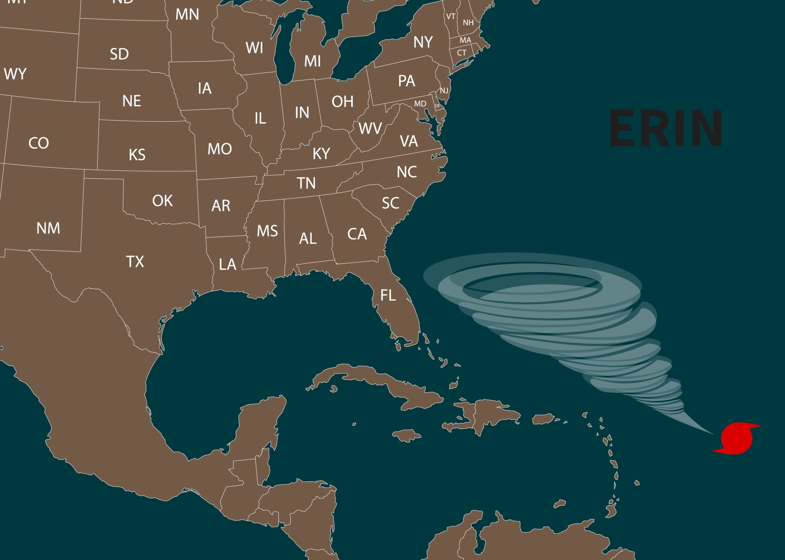
Hurricane Erin tracker reveals seven states most at risk as experts issue deadly warning
There’s a storm swirling in the Atlantic. Its name is Hurricane Erin, and even though it may never step foot on land, it has already shown just how powerful and unpredictable nature can be. Erin briefly surged to a Category 5 hurricane before easing back to Category 3, and while forecasters say it may weaken further, its size and force are enough to stretch across seven states. Sustained winds near 130 miles per hour, waves expected to rise as high as 20 feet, and rip currents strong enough to pull even the strongest swimmers under — these are not abstract numbers, they are real conditions that will affect real people. States of emergency have already been declared. Families are being told to pack up and leave. And this is before Erin even makes landfall, because the truth is, it doesn’t have to. Offshore storms can be just as destructive, reshaping lives and landscapes without ever crossing the shoreline.
But beyond the statistics, beyond the warnings on the news, Erin is a mirror. It reflects back something about the world we live in today, and about the choices we make in times of uncertainty. It reminds us that life changes fast, and it asks a question: when the storm comes — whether in the sky or in our own lives — will we be prepared? That’s where the real conversation begins.

The Reality of Erin Right Now
Hurricane Erin is moving slowly, about 13 miles per hour, and forecasters say this slow pace is what makes it so dangerous. Slow storms linger. They churn up the ocean, pulling cooler water to the surface and sometimes weakening themselves, but their wide size ensures the damage still spreads far and wide. Even hundreds of miles from its center, Erin’s presence is being felt. Coastal flooding alerts are in place. Beaches are closing. Rip currents are already developing. And from North Carolina to Massachusetts, communities are bracing for impact, not because the storm is landing directly, but because its reach is simply too vast to ignore.
North Carolina has taken some of the most serious steps so far. Mandatory evacuations are underway in Dare and Hyde counties. Ocracoke Island, a community already familiar with the cost of storms, has emptied out because officials know once Highway 12 floods, there is no way in or out. Residents have been told to leave while they still can, because hesitation in situations like this is often the difference between safety and regret. As one emergency management director put it, “I encourage all residents and visitors to heed the evacuation order and take action to protect themselves, to protect their property, and to get up and leave — now.” These aren’t words meant to frighten. They’re words meant to wake people up.
Farther north, states are also preparing, though the threats look different. In New Jersey and New York, the biggest dangers are the waves and rip currents that will hammer the shoreline for days. Beach towns, usually thriving with summer activity, are quieting down as businesses close and visitors cancel plans. In Massachusetts, the focus is on infrastructure, with power companies staging crews in advance to deal with expected outages. Every state is adapting to its own version of Erin’s threat, and together they show that a storm’s reach extends well beyond the map of its path.
Who Is Most Exposed
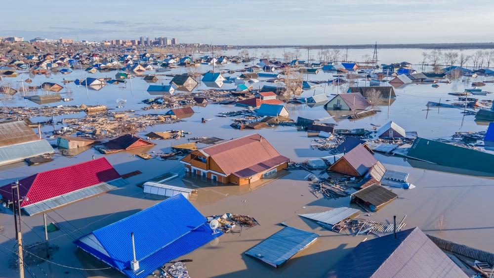
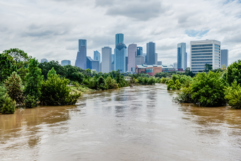
Seven states are now preparing for Erin’s impact: North Carolina, South Carolina, Georgia, Virginia, New Jersey, New York, and Massachusetts. Each one faces its own vulnerabilities. In the southern states, the geography itself makes the risks higher. Charleston and Savannah sit low, where tides can creep into neighborhoods even on calm days. Add a hurricane churning offshore, and those waters rise fast, filling streets, straining drainage systems, and putting entire districts at risk. For residents in those areas, “waiting it out” isn’t just risky — it’s reckless.
Virginia, New Jersey, New York, and Massachusetts are facing a different reality. Their danger isn’t storm surge from landfall, but the crashing surf and flooding caused by Erin’s offshore size. The Jersey Shore and Long Island’s South Shore — places known for their summer crowds and beach economy — are preparing for the kind of surf that erodes coastlines and closes beaches for weeks. In Massachusetts, officials are preparing not only for flooding but also for the cascading effects of power outages and transportation shutdowns. When utilities fail, it isn’t just lights that go out — it’s communication, refrigeration for food and medicine, and access to the outside world. Each state has its unique weaknesses, but the common thread is clear: no one in Erin’s reach is truly untouched.
This is what vulnerability means. And it’s not something to hide from. Vulnerability is an invitation to prepare. To acknowledge where we are exposed and then to act with intention. The people in these seven states aren’t weak for facing risk — they’re strong for confronting it head-on. That’s a lesson worth carrying far beyond the storm.
What Science Teaches Us About This Storm
Hurricane Erin’s behavior has kept meteorologists on edge because of how fast it has shifted intensity. Within hours, it surged to a Category 5 storm, with winds capable of catastrophic damage, before falling back again. Scientists explain that this is the result of competing forces. Favorable upper-level winds and atmospheric patterns can strengthen it, while the storm’s slow movement pulls cooler waters to the surface, cutting off some of its fuel. This push and pull makes forecasting more difficult, which is why experts continue to stress caution. When nature moves like this, uncertainty itself becomes a risk factor.
Satellites have been crucial in tracking Erin. High-resolution data now lets forecasters measure wind speeds, storm size, and surface temperatures with precision. For Erin, these measurements show one undeniable truth: size matters. Even when winds dip, the sheer width of a hurricane like Erin ensures that it brings destructive power to large areas. It’s not always the sharpest punch that does the most harm — sometimes it’s the broad, slow-moving force that lingers long enough to wear everything down.
Scientists also place Erin in the bigger picture of climate change. Warmer oceans provide more energy for hurricanes, fueling rapid intensification events like the one Erin displayed when it leapt to Category 5. Researchers are also documenting that hurricanes are moving slower, stalling over regions and dropping devastating amounts of rain. Erin may not make landfall, but its behavior reflects these trends, raising urgent questions about how communities will face storms that are not only stronger but also less predictable. If the climate is changing, then our preparation and our mindset must change with it.
How Communities Are Responding on the Ground
The human side of Erin is already visible. Families are evacuating. Businesses are shuttering their doors. In North Carolina’s Outer Banks, thousands have left their homes, taking only what they can carry, unsure of what they’ll return to. Evacuations aren’t just logistical exercises. They’re emotional ones. They force people to leave behind the comfort of familiarity, to trust that safety lies somewhere beyond the storm, and to face the uncertainty of displacement. For those with fewer resources, evacuation becomes even harder. Gas money, lodging, food — these are not small concerns when survival is at stake.
Officials are doing what they can to keep people safe. Communication has become as important as sandbags and storm shutters. Press briefings, social media alerts, and direct text messages are being used to spread one message: don’t underestimate Erin. Donnie Shumate, public information officer for Hyde County, put it bluntly when he warned that while Erin will stay offshore, it is still expected to render Highway 12 impassable and bring life-threatening conditions to Ocracoke Island. This kind of clear, unfiltered information can save lives if it convinces people to act in time.
In northern states, communities are preparing in different ways. In New Jersey and New York, coastal businesses are bracing for lost income as beaches close during what should be their busiest season. In Massachusetts, power companies are staging crews to respond quickly when lines go down. These ripple effects remind us that hurricanes are never just about weather. They’re about safety, health, economics, and the systems that keep our daily lives functioning. Erin hasn’t made landfall, but its shadow is already shaping decisions and disrupting routines across the coast.
What We Can Learn and Do Right Now
Storms like Erin are not just warnings from nature. They are teachers. They remind us of the urgency of preparation and the cost of ignoring what we know to be true. Preparation isn’t complicated, but it is powerful. It is the line between chaos and survival. Right now, the steps that matter most are simple but non-negotiable:
- Evacuate when ordered. The cost of leaving is far less than the cost of staying behind.
- Keep essentials ready: water, food, medications, batteries, flashlights, and first aid. Think of what you’d need if services were cut off for days.
- Secure your space: bring outdoor items inside, cover windows if possible, and ensure your vehicle is ready if you need to move.
- Stay connected through official sources like the National Hurricane Center. In moments of uncertainty, misinformation spreads fast, and it can be as dangerous as the storm itself.
- Avoid the water. Rip currents don’t negotiate, they don’t discriminate, and they remain deadly long after the skies clear.
These steps protect lives today. But Erin also forces us to think beyond the immediate storm. Climate change is fueling stronger, slower, more unpredictable hurricanes. That means preparation cannot be a one-time act. It has to become a way of life for coastal communities. Stronger infrastructure, smarter building codes, and collective awareness will be necessary as these storms continue to evolve.
And here’s the deeper lesson: storms don’t just happen in the sky. They happen in our lives. Financial setbacks. Mental health struggles. Personal losses. Like hurricanes, they come whether we expect them or not. But the way we prepare — the networks we build, the tools we gather, the mindset we strengthen — determines how we come out the other side. Erin is not just a storm offshore. It’s a reminder that the winds may rise and the waters may crash, but preparation and awareness are choices we can control. And those choices can save not just homes and lives, but futures.